
5.9K
If your car is running low on fuel, you can have Google Maps show you the petrol stations in the vicinity. This way, you can find a suitable petrol pump even in unfamiliar places. We show you how to use this function in this practical tip.
Display nearest petrol station in Google Maps

If you just want to look for the nearest petrol station, you can do this with a simple search command:
- To do this, open Google Maps in your browser or the Google Maps app for Android or iOS on your mobile device.
- At the top of the search field, enter “Braunschweig petrol station”, for example, and confirm your entry. Of course, you can adjust the search phrase depending on where you are. You can also simply enter “petrol station” or click on the corresponding symbol.
- During your search, you can simply press on “petrol stations” on the top left of the map in the browser and when you have found the right one, select it and click on “insert stopover”.
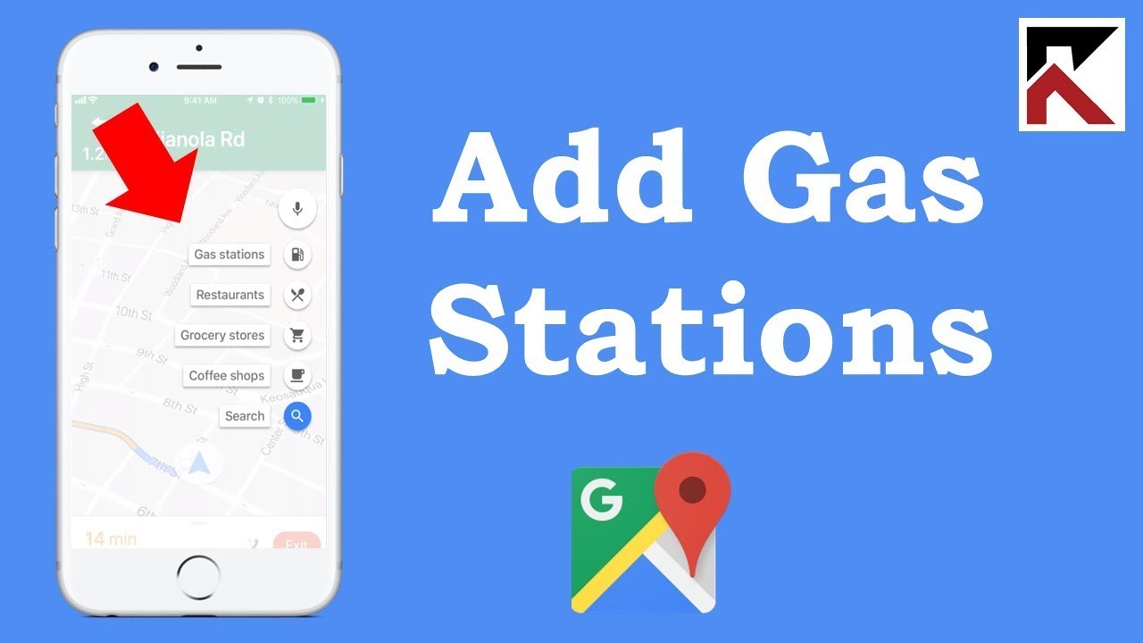
- In the app, this is also easy to do: select the magnifying glass for your current route and then tap on the petrol station symbol and then on “Insert stopover”.
- The available petrol stations are then shown on the map and you can navigate to them. Tip: The app also shows you the current fuel prices.
Add petrol pump as a stopover in Google navigation
If you are already in a navigation, you do not have to cancel it. It is not necessary to create your own route to make a foreseeable petrol stop. You can also simply insert the petrol station as a stopover.
- For a detailed explanation of how to insert stops into your navigation on Android or iOS, see the linked articles.